AI helps detecting plastic in oceans
Our society relies heavily on plastic products and the amount of plastic waste is expected to increase in the future. If not properly discarded or recycled, much of it accumulates in rivers and lakes. Eventually it will flow into the oceans, where it can form aggregations of marine debris together with natural materials like driftwood and algae. A new study from Wageningen University and EPFL researchers, recently published in Cell iScience, has developed an artificial intelligence-based detector that estimates the probability of marine debris shown in satellite images. This could help to systematically remove plastic litter from the oceans with ships.
Automatic analysis
Accumulations of marine debris are visible in freely available Sentinel-2 satellite images from the European Space Agency that capture coastal areas every 2-5 days worldwide on land masses and coastal areas. Because these amount to terabytes of data, the data needs to be analysed automatically through artificial intelligence models like deep neural networks. Marc Rußwurm, Assistant Professor at Wageningen University and former researcher at EPFL: “These models learn from examples provided by oceanographers and remote sensing specialists, who visually identified several thousand instances of marine debris in satellite images on locations across the globe. In this way they ‘trained’ the model to recognise plastic debris.” Devis Tuia, associate professor at EPFL and Director of the Sion-based Laboratory of Computational Science for the Environment and Earth Observation (ECEO), is corresponding author of the study.
Improved detection
The researchers developed an AI-based marine debris detector that estimates the probability of marine debris present for every pixel in Sentinel-2 satellite images. The detector is trained following data-centric AI principles that aim to make best use of the limited training data that is available for this problem. One example is the design of a computer vision algorithm that snaps manual annotations from experts precisely to the debris visible in the images. With this tool, oceanographers and remote sensing experts can provide more training data examples by being less precise in the manual clicking of outlines.
Overall, this training method combined with the refinement algorithm teaches the deep artificial intelligence detection model to better predict marine debris objects than previous approaches. Rußwurm: “The detector remains accurate even in more challenging conditions. For example when cloud cover and atmospheric haze make it difficult for existing models to identify marine debris precisely.”

Heavy precipitation over Durban, South Africa on 22 April 2019, 19:00. Continued precipitation between 18th and 22nd of April lead to the Durban Easter floods 2019 that washed substantial amounts of plastic litter into the Indian ocean, which are visible in Satellite images. Map data © 2023 Google. Precipitation data © JAXA Global Rainfall Watch
Following plastic debris
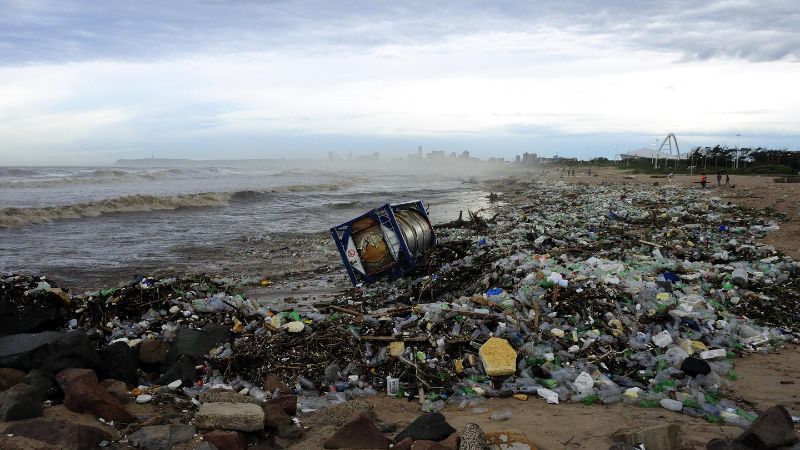
Detecting plastics in marine debris under difficult atmospheric conditions with clouds and haze is particularly important, as often plastics are washed into open waters after rain and flood events. This is shown by the Durban Easter floods in South Africa: In 2019 a long period of rain led to overflowing rivers, resulting in much more litter being washed away than normally. It was taken along through the Durban harbour (left picture) into the open Indian Ocean (right picture). In satellite images, such objects floating between clouds are hard to distinguish when using common red-green-blue colour ‘channels’. They can be visualised by switching to other spectral channels, including near-infrared light.
Double view
Apart from more accurate prediction of marine debris aggregations, the detection model will also notice debris in daily-accessible PlanetScope images, coming from cubic nanosatellites. “Combining weekly Sentinel-2 with daily PlanetScope acquisitions can close the gap towards continuous daily monitoring”, explained Rußwurm. “Also, PlanetScope and Sentinel-2 sometimes capture the same patch of marine debris at the same day only a few minutes apart. This double view of the same object at two locations reveals the drift direction due to wind and ocean currents on the water. This information can be used to improve drift estimation models for marine debris.”

The scientists tested the AI model predictions on Sentinel-2 satellite images of challenging atmospheric conditions with clouds and haze. In red, the correctly detected debris with plastic waste. © ESA / Cell iScience
Further explorations
These directions will be explored further in the research of Prof. Marc Rußwurm at Wageningen University together with Prof. Tim van Emmerik, who is an expert in river plastics, and partners in the Netherlands, such as the Ocean Cleanup, who collect plastics on open oceans with dedicated ships. It originates from work in the AI for Detection of Plastics with Tracking (ADOPT) project in collaboration with the Swiss Data Science Center (a joint venture between ETH Zurich and EPFL) and EPFL by Prof. Devis Tuia, Dr. Emanuele Dalsasso, and Prof. Marc Rußwurm that investigates the continuous tracking of marine debris in between satellite imagery further.
Sentinel-2 and PlanetScope
ESA’s Sentinel-2 satellite constellation from the European Space Agency consists of two large satellites that cover the Earth every 2-5 days. They measure the reflected light in multiple spectral channels beyond the visible red-green-blue and up to 10m pixel size. The images are openly available.
PlanetScope Doves and SuperDoves make up a constellation of several hundred small CubeSats (nanosatellites) that cover the Earth every day at 3-7m pixel resolution. The images are not free to acquire, but can be used to a limited extent for research purposes at no cost through a Research and Education programme.
