Losing rivers
Water is an ephemeral thing. It can emerge from an isolated spring, as if by magic, giving birth to a babbling brook. It can also course through a mighty river, seeping into the soil until all that remains downstream is a dry streambed, the nearby trees offering the only hint as to where the water has disappeared.
Those who use this vital resource due to the difficulty of studying it often overlook the interplay between surface water and groundwater. Scott Jasechko of the University of California Santa Barbara (UCSB) and his colleague Hansjoerg Seybold from ETH Zurich leveraged, together with their research teams, an enormous database of groundwater measurements to investigate the interaction between these related resources. Their results, published in the journal Nature indicate that many rivers across the United States may be leaking more water into the ground than previously thought.
In many places surface waters and groundwater connect, while in others impermeable rock layers separate them. It depends on the underlying geology. Where they intermingle, water can transition between flowing above and below ground.
4.2 million wells analyzed
“Gaining rivers” receive water from the surrounding groundwater, while “losing rivers” seep into the underlying aquifer. Scientists did not have a thorough understanding of the prevalence of each of these conditions on a continental scale. “Simply put, no one had previously stitched together so many measurements of groundwater,” explained Jasechko, the study’s co-lead author.
Typical groundwater studies include water level measurements from a few hundred to 1,000 wells. This study encompasses 4.2 million. Jasechko and co-author Debra Perrone devoted years to compiling data from 64 agencies across the U.S. and analyzing the results.
For this paper, a team of researchers from UCSB, ETH Zurich, and Rutgers University compared water levels in wells to the surface of the nearest stream. “We apply a simple method to a large dataset,” Jasechko said. “We identified wells with water levels that lie below the nearest stream, implying that these nearby streams could leak into the subsurface if it is sufficiently permeable.”
Pumping the rivers dry
The researchers found that nearly two-thirds of the wells had water levels below the nearest stream. This creates a gradient that can drive water from the river channel into the aquifer beneath.
“Our analysis shows that two out of three rivers in the U.S. are already losing water. It’s very likely that this effect will worsen in the coming decades and some rivers may even disappear,” said co-lead author Hansjoerg Seybold at ETH Zurich.
“The phenomenon, set in motion decades ago, is now widespread across the U.S. There are far more streams draining into underlying aquifers than we had first assumed,” Seybold continued. “Since rivers and streams are a vital water supply for agriculture and cities, the gravity of the situation came as a surprise.”
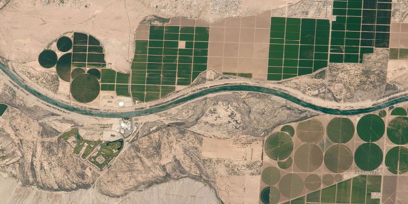
Rivers were particularly prone to losing water in arid regions, along flat topography and in areas with extensive groundwater pumping, they observed. A prime example of this would be flat agricultural land in semi-arid regions like California’s Central Valley. “We are literally pumping the rivers dry,” Seybold said.
Unintended consequences
Losing rivers can affect other water users, downstream communities and ecosystems that rely on surface flows. “Historically, we’ve often treated these two resources as separate resources,” Perrone said. “Our work highlights the importance of considering groundwater and surface water as a single resource where they are connected.”
The researchers also found that losing rivers has been widespread in the U.S. for quite some time, present in many places at least as far back as the 1940s and ‘50s. In addition, while many waterways naturally lose water, human activity can exacerbate the issue.
Humans have extracted water from the ground for thousands of years; in America, they have been doing so for hundreds of years. The practice, accelerated after World War II and rampant since the 1970s, entails undesirable and unintended consequences. “This isn’t a new phenomenon,” Jasechko said. “It's been with us for decades.”
Informing policy
Water levels do fluctuate over years and decades, and unfortunately, the researchers have only one data point for many of the wells in their sample. Other work by the team suggests that groundwater typically fluctuates by no more than a few meters over the course of a year. However, the water level for the many wells near losing rivers was more than two meters below the surface of the nearest stream, increasing the researchers’ confidence that leaky rivers are likely widespread.
“We can only observe well water levels where wells exist,” Seybold acknowledged. “It’s an obvious but important point. Our analysis is inherently biased to places where wells have been drilled, and therefore also to places where groundwater is pumped.”
While the researchers do not see any straightforward way around this in the short-term, they hope their results can inform resource management and monitoring, perhaps informing policies that fund more monitoring wells in under-surveyed areas.
